Hi everyone. Normally I like to write before I post photos, but this week I am doing just the opposite.
I finished my moon course eight days ago, and had every intention of traveling immediately to Antigua to spend two weeks catching up on my blog. But then we got hit with Tropical Storm Agatha and I got stuck here in San Marcos (and now San Pedro) with severe diarhea and stomach upset. For the last two days I have finally been able to hold down rice and bananas, and I would say that I am back to about 60% of normal strength — still weak but getting stronger every day.
I have not felt capable of writing yet, so I haven’t … but yesterday I finally got enough energy to organize and upload my photos, and today I hope to post them. Tomorrow I travel to Antigua and plan to spend a few days writing.
For those interested in seeing the effects of Tropical Storm Agatha on the town of San Marcos, the last forty photos show some of that damage.
As usual, all photos here are thumbnail images. If you click on any photo, you can see/download a high resolution image.
Trip From Xela To Lake Atitlan
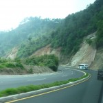
It is hard to believe that I traveled from Xela to San Marcos on April 26 — almost six weeks ago. While the road over the mountains was high and winding, you can see from this photo that much of the road was actually quite nice — divided, two lanes in each direction, and smoothly paved.
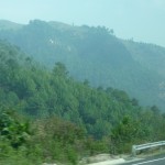
Just another sample of the mountainous terrain that we passed through. Xela is over 7,000 feet, and Lake Atitlan is over 5,200, but we passed a very tall mountain pass between the two locations.
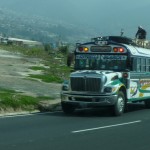
One of the many typical buses that we passed during our journey. The international travelers like to call these “Chicken Buses” because the locals bring just about anything along as baggage. I never saw any actual chickens on my buses, but I did see chickens on one of my boat rides on the lake.
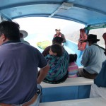
After arriving at the town of Panajachel on Lake Atitlan, I hopped into one of these small launches for a 40 minute boat ride to San Marcos. Just like the chicken buses, these little boats can get quite crowded. On one journey there were over 25 of us crowded on the benches, in the front, and even one or two on top.
As you can see, almost all passengers are Mayan. I love the little toddler hanging over the woman’s shoulder two rows up.
Looking back as we pull away from the boat docks at Panajachel. Panajachel is a town of over 11,000 residents on the northeast shore of the lake.
Still looking back at Panajachel. This is the “Riviera” portion of town. The real town is off to the right, not shown in the photo.
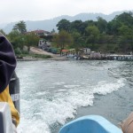
Looking forward out the right side of the boat as we make our way up the lake. As you can see, there was a lot of haze during my first week here. The rains have washed away much of that haze now. The lake is much more beautiful without the haze.
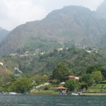
One of several small villages that we passed along the way to San Marcos. This village looks like Santa Cruz.
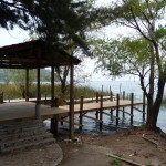
This is the public boat dock where my boat landed and I took my first steps in the village of San Marcos, a small town with just over 2000 residents situated on the northern shores of Lake Atitlan, near the northwestern corner of this very large lake.
The Village of San Marcos
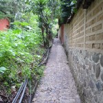
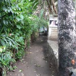
There is only one main road that runs through the center of town, plus another small one that goes up onto one hillside. Most of the village of San Marcos is connected by mazes of small footpaths. The majority of these paths are dirt. A few of the more major ones (such as this one) are paved. Directly behind and to my right is the boat dock. Straight ahead about 200 yards up the hill is the road that runs through town.
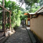
More of the same path, a little further up. On the right is the “Fe” restaurant where I ate a few of my meals. On the left (not visible) is a tiny store where I bought a few items …
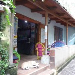
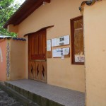
This is the outside of the “Blue Lily” restaurant, just a little further up the path. I became friends with Kathleen who owns and runs the small cafe, and I ate oatmeal here almost every morning.
Another typical path through the lower area of the village. This one is dirt/mud.
This is one of only two internet shops in the village. The service is quite slow, not capable of running skype — but I was able to frequently check emails and update Facebook.
Las Piramides Del Ka
I participated in the 29 day “Moon Course” which started on April 29 and ended on May 27, 2010. These courses start the day after every full moon and end on the subsequent full moon.
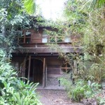
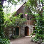
This is the building where I lived. I spent two nights in a tiny loft at the top right of the building in the photo (not visible). Then I spent one night in a small room whose windows are the top left windows. I spent my final four weeks in a larger room whose windows are the top right windows with the white curtains.
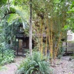
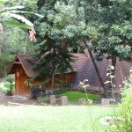
Another photo of my building, showing some of the surrounding trees.
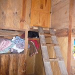
This is the ladder that I had to climb several times per night to get into my tiny loft room during the first two nights. This picture is taken from the second floor, at the top of a steep flight of steps.
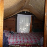
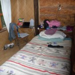
This is my tiny loft room … I could actually sit up in the middle of the bed, but not anywhere else. The room was very cramped.
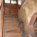
This is the steep flight of stairs that leads from ground level to the second floor. The room where I spent the majority of my time is at the top right of these steps.
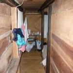
After climbing the steps and carefully stepping up and into my doorway, I had to make a sharp right and squeeze down this tiny ten foot hallway. I can barely stand up in this room, but must have bumped my head on the cross beams at least once every day.
This is the actual bedroom where I spent four weeks. I loved my window and my little desk. … although I did get quite a few bug bites.
This is the view out my window. I loved sitting with the windows open and listening to the birds while enjoying the fresh air. The mosquitoes didn’t make it up to the second level much.
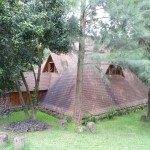
Many of the guests sleep in pyramids like these, but I wanted a private room, and the one-bed pyramids were all spoken for.
More of the beautiful grounds at Las Piramides.
This is the main reception area.
This is the main pyramid temple where we did all of our yoga, meditation, and classes.
Another view of the main temple.
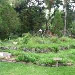
The medicinal garden … watch out for ants in a few spots … they really like to bite … ouch.
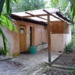
The main bathroom building — two toilets and two showers shared by about 25 people — not the cleanest place I have ever visited.
Daytrips to San Pedro
San Pedro is a small town of about 13,000 residents situated about a ten minute boat ride from San Marcos. I went there on a few occasions during the moon course, and am now spending a week here to recover from my stomach/intestine problems.
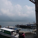
This is the boat dock in San Pedro. San Marcos is just across the lake, around a bend behind the mountain that disappears into the lake at the far right side of the photo. The huge 9,908 foot “San Pedro Volcano” stands behind me.
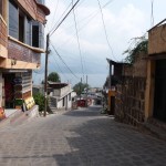
One of the cobblestone streets in San Pedro. This one is quite steep and is very tiring to climb.
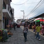
The market at the top of the hill. I only visited this area once during the moon course. I now go there every day to try to find bananas to eat.
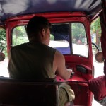
On May 18th, my friend Stephen and I decided to take a ride in a Tuk-Tuk (three wheeled Taxi) from San Marcos to San Pedro. There is a slow road that runs between the two, and which passes through two other small villages. The taxi ride actually takes twice as long as the boats, and costs twice as much as well.
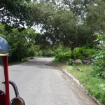
Scenery along the way to San Pedro.
A view from a small foot path in San Pedro, looking back across the lake toward the village of San Pablo (between San Marcos and San Pedro).
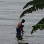
Stephen and I stopped for lunch in San Pedro at a Japanese Restaurant (Mikaso) with a great third-floor balcony view. I couldn’t resist taking this photo (full zoom) when we saw a Mayan man trying to teach his young son how to swim.
A view from the restaurant balcony looking off toward the San Pedro Volcano — a volcano which seems to be covered in clouds most of the time.
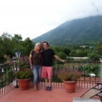
Stephen and I on the balcony at the restaurant with the San Pedro volcano as our background.
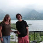
Another photo of Stephen and I, this one with the village of San Pablo as our backdrop across the lake.
Moon Course Friends
I made many friends during my four week moon course. Following is an assortment of friend photos.
This is my friend Donna from Austrailia. In the background is Amanda.
Amanda loves to do laundry in our handy do-it-yourself laundramat.
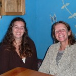
Lise (left) and Mary (right).
One night before our six day restricted-diet fast, most of us went to a local Japanese restaurant for dinner. This is Tessa (left) and Sarah (right).
Left to right: Alia’s boyfriend (who was not part of the moon course and I cannot remember his name), Alia, Stephen.
Heather
Left to right: Me, Jessica, Donna
Donna and Barak.
Me, Sarah (standing), Jessica, Donna, and Barak (far right).
Barak (from Israel).
Another photo of Barak.
And another photo of me, Jessica, and Donna. You might want to pay attention to the background of the restaurant. I have storm damage photos later of the same area.
Left to right: Stephen, Tessa, Sarah, Me, Jessica, Donna.
Dessert was delicioius …
Stephen, Tessa, and Sarah enjoying their desserts.
Sam (Samantha) and me sitting in front of the temple.
May 27 – Graduation day
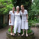
On Thursday morning, May 27, at 7:00 a.m. we had our official ceremony to end what is normally a five-day restricted diet fast. We all dressed in white for the ceremonies, and intended to take photos immediately afterward … but the rains of what was to become Tropical Storm Agatha had already started when the ceremonies ended.
I was wearing borrowed white clothes so I ran back to my room to change so as to keep them clean and dry. During a short break in the rains, shortly after 9:00 a.m., I found a small group of my friends taking photos, still in their white clothes … I was too lazy to run back to change into white.
Lise (barely showing on left), Amanda, and Mary.
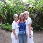
Left to right: Tessa, Me, Amanda, Mary, Erin, Lise, Sarah, Heather, Donna.
Note–we had 14 in our group. Not present during this impromptu photo shoot are Stephen, Sam, Barak, Jessica, and Alia.
Erin, Mary, Lise
Sarah and Heather
Donna
Mary and Erin, preparing to jump from a wall …
Amanda and Lise.
Me and Mary
Mary, me, and Amanda
Jessica
All day Thursday, even though we had already participated in closing ceremonies (Chaty, our main teacher, had to leave in the morning), we continued fasting, with the final day being only water. For me, the first five days had been on minimal baby-food-like soups and fruit juices.
That evening, at 5:00 p.m. we had our final meditation. In this photo, we are waiting to enter our final meditation ceremony.
Foreground: Donna and Me
Background: Alia, and a couple of folks from the Sun group
Tessa and Alia waiting for our final meditation.
Barak and I waiting for meditation. Bad camera angle, but I love the photo anyway.
Kathy — one of our staff, with Maria down inside the door to the temple.
Maria – this beautiful Mayan woman works at Las Piramides, helping keep the temple clean among other responsibilities.
Our final meditation is over, we can finally talk after nearly six full days of silence, and Jessica and I are pouting over our hungry and starving tummies from not having eaten very much during those six days.
Me, Tessa, and Jessica (giving thumbs up) as we prepare to go eat our first actual meal since last Friday night (it is now Thursday night).
Alia playing photographer before our dinner trip.
Me and Sam, right before dinner at Ganesh’s restaraunt.
Me and Michelle right before dinner. She was one of our weekend meditation teachers, and I also had an incredible Acupuncture and Cranial Sacral Massage session with her.
Jessica enjoying her first meal …
Me enjoying the barbeque sauce on my Pork Ribs — I had not yet grown to regret my choice of meals …
Loving food … FOOD, FOOD, glorious FOOD.
Stephen and Sam enjoying their first meals in six days.
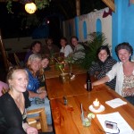
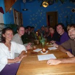
Left to right: Tessa, me, Donna, Stephen, Alia’s boyfriend, Alia, Sam, Sarah, Jessica
Left to right: Alia, Sam, Sarah, Jessica, Barak, Tessa, Me, Donna, Stephen, Alia’s boyfriend
Michelle and Sam
Scenery Around San Marcos
This photo is taken from atop the small mountain directly west of San Marcos. I climbed up here on May 26th to do some emotional processing and to get a few panaramic photos.
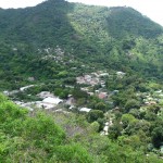
In this photo, we are looking down at the main lower section of San Marcos. The prominent visible landmark is the futbol (soccer) field right in the middle of the valley. The Las Piramides meditation center is on this side of the futbol field, considerably closer to the lake.
Another photo of San Marcos. The rounded-top stadium like building in the lower left center is an indoor basketball court (but I never saw any hoops). This sits right on the main road that runs from the lower left to the right center of the photo. Up on the hill is the neighborhood known as “Barrio Uno”. The flash flooding of a few days later came down the canyon just to the left of Barrio Uno. Much of Barrio Uno was evacuated during the storm.
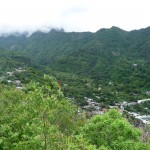
This is another photo of San Marcos taken a little more to the left. On the hill at the left side of the photo, you can see signs of homes in Barrio Dos, and on the far right are homes of Barrio Uno. The main village below (bottom right) is called Barrio Tres. You can barely see the basketball court at the bottom right.
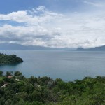
Looking out toward the lake from the same spot. You can barely see the edge of the soccer field at the bottom left. This was taken on one of our clearer days. We had received quite a bit of rain over the previous two weeks, but mostly at night.
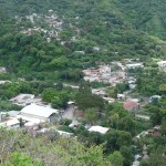
A slightly zoomed in view of the main center part of San Marcos. You can barely see the road in front of the basketball court (round-topped building).
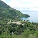
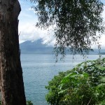
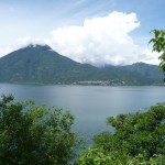
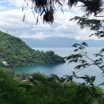
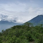
A pretty photo looking out at the lake with the base of a volcano on the other side.
This photo was taken from a beautiful spot on the mountain just west of town. I came here a couple of times to do some emotional processing when I was struggling. I love the view here.
A beautiful photo of the San Pedro Volcano with the small town of San Pedro nestled in below on the bottom right of the volcano. I am currently in this town in a small hotel near the waterfront at the bottom right edge of the buildings.
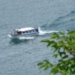
Looking down with a zoom lens at one of the many passenger boats that go up and down the lake, at least every 30 minutes, sometimes more often.
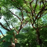
Some fascinating trees with a view of the water below.
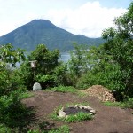
Near the top of the mountain west of town is this little Mayan ceremonial site that is still used for ceremonies. I was invited to attend one ceremony, but never found out the exact time. In the background is the San Pedro volcano.
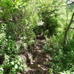
Part of the trail on which I hiked to climb to the top of this small mountain.
Another view from my favorite spot.
On the right is the San Pedro volcano. On the left, buried by clouds are the Toliman and Atitlan volcanoes.
Volcano Atitlan is the one furthest back on the right. It is 11,604 feet high. Volcano Toliman is the middle peak. It is 10,361 feet high. The other closer peak on the left is called “Cerro de Oro” and is 6,207 feet high.
Volcano Atitlan last erupted in 1853.
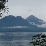
A more zoomed in photo of the same three peaks. I’m not sure if “Cerro de Oro” is a volcano or not, but it’s name (with no details) does show up on a website list of volcanos in Guatemala.
A single photo with all of the volcanoes. San Pedro is on the right. Atitlan is the tallest and furthest away in the middle. This is a rare photo to have no clouds covering the tops of any of the volcanoes.
This photo was taken from some rocks that I like to sit on close to the water. I am looking back at a small swimming beach. The village of San Marcos is burried back in the trees.
Another beautiful photo of all of the volcanoes, this one being taken from the shoreline.
These rocks (below) are the place where I sat and meditated, and from where I swam, during our six days of silence and partial fasting.
Looking at my meditation rocks (just before the point) as seen from the swimming beach.
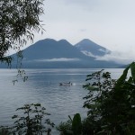
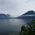
The lake was so beautiful today that I just kept taking more photos of the volcanoes and the smooth water.
Another beautiful photo.
And another.
And one last beautiful scenery photo.
Posada Schuman
On the morning of May 28, 2010 I participated in one last Yoga class, packed my bags, and moved into a beautiful $12.50 room at Posada Schuman. I had intentions to spend two nights resting and regrouping before traveling on to Antigua to begin writing.
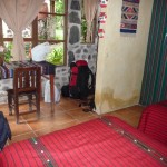
I loved this beautiful room with private bathroom (including working hot water).
But Mother Nature and Body Nature had different plans. By Saturday morning the rains from the advance of Tropical Storm Agatha had been hitting us nonstop for almost two days. The core of the storm had not even hit landfall yet, and was predicted to be heading right for the heart of Lago de Atitlan, pounding us all day Sunday and lingering for another day or two.
Based on gut feel, my friend Donna and I moved out of our separate rooms in the low-lying area of Posada Schuman and ended up sharing a hotel room at Hotel Quetzal, on slightly higher ground.
After moving my backpack to a second floor room, I was walking down a flight of very slippery outdoor tile stairs (in the rain) and my feet went out from under me. Other than a bruised ego, I also acquired a very deep purple behind — but no broken bones — as I bounced and slid down the bottom six feet of hard steps.
To top it off, I was feeling very sick and weak after having partially fasted for six days, and then not being able to eat much of anything all day Friday. I was feeling extremely weak.
Early Saturday afternoon, we lost both electricity and tap water — making it quite difficult to flush toilets … and the diarhea was beginning … fun fun fun.
Saturday evening as I was attempting to force my stomach to allow me to consume two tiny pieces of pizza, the rains stopped suddenly. We heard a report that the storm had turned and gone up the coast. I assumed that San Marcos and Lake Atitlan had dodged a bullet. I couldn’t have been more wrong.
Tropical Storm Agatha
On Sunday morning I got up early, still feeling very weak but unable to sleep, and took a walk around the village to explore the possible damage. I was not expecting very much damage … I was quite surprised by what I found.
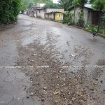
As I started walking down the street from the Hotel Quetzal on the west end of town, this is what I expected to see — nothing more. Just lots of miscellaneous debris from a little water running down the streets.
When I reached the one main car bridge over what is usually a dry storm channel, I was shocked by what I found … but I will start up the river a bit.
In 2005, I am told that a large portion of San Marcos was wiped out by flash flooding and mud slides as Hurricane Stan parked itself over the Lake Atitlan area for a few days. As part of the post-hurricane rebuilding effort, a flood-control river channel was built running from the dry river up the canyon through the entire center of town. The intent was that the flood waters would remain in this channel, preventing damage to the homes of the local people.
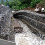
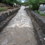
This photo shows the man-made river channel, created from huge chain-link bundles of heavy rock. It looks to be about 12 feet high and twelve feet wide. I had been here Saturday afternoon during the rains, and you could hear large boulders crashing down this channel as the water pushed them forward.
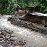
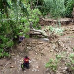
Sometime during the night, the wall of this channel fell in on itself, forcing the water to go around the channel, carving a deep cut into the side of the hill. Over 14 hours after the rains had stopped, the water was still flowing …
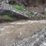
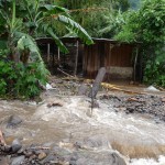
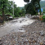
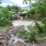
This photo shows the water running around what is supposed to be the water channel.
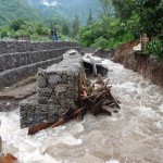
Just below where the water left the channel, it hit a small bridge and then flowed back into the main channel. As you can see in this photo (looking down toward the lake below) the twelve foot deep channel quickly filled up with debris and large rocks, causing the water to overflow the banks of the protective channel.
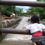
One of my favorite photos — a young Mayan girl watching the raging waters below …
This photo is taken a little further upstream, looking down at the toppled wall.
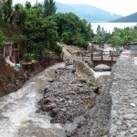
And this photo is a little further upstream. Most of my previous photos were taken from this small bridge in the photo’s center.
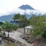
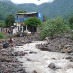
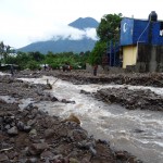
This photo is taken further downstream, at the point where the river channel is completely burried, and where the water begins to flow wherever it wants to flow. The tall blue building (center) is right by the main road through town, where the main car bridge is located.
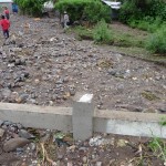
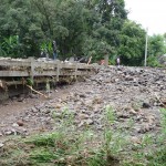
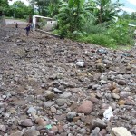
This is the main bridge over the river channel. The Mayan woman (left center) is standing in what is supposed to be the middle of the bridge. Instead, she is standing on several feet of rock that is piled on top of the bridge. The bottom is completely plugged up, and the river flowed over the top, dumping more debris. From here the raging waters scattered through various parts of the village.
Another view of the bridge.
This is from the front (west) side of the bridge, looking down below at what used to be a twelve-foot-deep river channel. Many homes from here down were flooded or heavily damaged.
Another view taken from atop the bridge with the railing below me. You can barely see the chain-link wall (right center) of what used to be the edge of this river channel. The small homes at the top right received heavy water damage.
A view of the bridge from below. The far side (east) is where most of the water continued flowing and depositing debris.
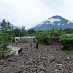
The beauty of nature in the background. The fury of nature in the foreground.
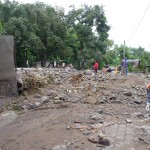
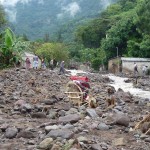
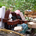
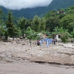
A lone wooden chair, half burried in the rubble, piled high with someone’s humble belongings. These beautiful people combing through the destruction did not have a lot to lose. Many of them lost it all.
As I walked around this area, I had a very difficult time holding back my emotions as I imagined what the local people must be feeling.
This photo was taken from the main bridge, looking back upstream toward the first small bridge where I took the original photos.
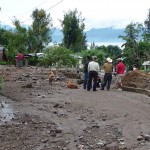
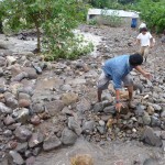
For most of the day, many people worked to rearrange rocks, creating a small channel for the water to flow, trying to redirect it away from homes and property so that people could begin the cleanup.
Just a few of the many people attempting to move and stack rocks to create the new channel.
This is the Japanese restaurant where many of my friends and I ate dinner on Thursday evening, just ten days earlier. The pile of smashed chairs could very well contain the chair that I was sitting on.
The force of the river ran right through the middle eating area of the restaurant.
Another photo of the restaurant. I’m not sure, but it looks as if the main kitchen building may still be there. The patio eating area was completely washed away/covered up.
More of the out-of-control water having it’s way with people’s property. Just above here, a Mayan women’s sewing collective was completely washed away. Luckily, they saved their sewing machines from being ruined. I saw a whole collection of sewing machines stacked on a hillside just above where the river jumped it’s banks.
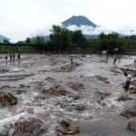
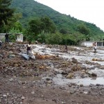
This is the soccer field as seen from the mountain in previous photos. The river fanned out over the field depositing several feet of mud and rocks. It then flowed over the far side and down between more expensive homes, undermining several homes and cutting gashes in property etc…
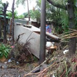
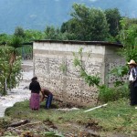
Some more of the damage to the small Mayan homes near the soccer field. This looks like some kind of shed or outhouse.
The upper part of he soccer field by the river bank. This used to be level. The Japanese restaurant is just above the two men in the left center of the photo. You can see that a huge amount of debris was piled on this part of the soccer field — at least six to eight feet deep. The left side used to be a hill where the soccer field was dug out to make it level.
More damage from the water on a nearby shed that survived. The water level was at least two feet deep on this shed based on the wood discoloration.
Many other structures like this were most likely washed away. I wish I had before photos …
Another photo up by the main road, showing how the water just goes where it wants.
Many of the sewing machines that were rescued sometime during the night. The building that housed these seamstresses was completely washed away.
This is taken from atop the main bridge, looking down what used to be the road running to the east. As you can see, a good portion of the river flowed down this road before cutting downward through other people’s properties.
This photo is taken from down the road to the east, looking back up about 50 yards toward the bridge. This photo was taken at 8:45 a.m. when the water was still flowing down the road — before people moved rocks to reroute the channel.
Out of control water rushing down between humble homes, more than 13 hours after the rains stopped.
This little home was still an island at 8:45 on Sunday morning. It is very lucky to still be standing, as water raged on both sides of it…
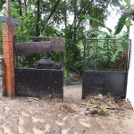
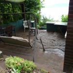
I took a short walk down the road to visit a Hostel where my friends Gael and Clara had slept just several weeks earlier. The water and mud had a heyday here. As I walked through the gate, my flipflops got stuck in more than 12 inches of mud backed up behind the gate. Once the water got through the gate, It formed a river to the lake below.
The buildings in the Hostel Del Lago got off easy, with relatively little structural damage — just several inches of mud in the ground floor rooms and kitchen area. This photo is just below the kitchen area.
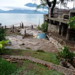
This is the lower property of the Hostel Del Lago. The little blue ball thingy sticking up in the middle of the water used to be a spa/sauna. It is now covered in mud and water. You can’t see it in this photo, but the dock below is surrounded by mud.
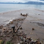
This used to be the Hostel Del Lago’s private boat dock. It was actually quite a nice place to sit and swim. Now the mud has completely filled in all around it. No more dock — just a wooden sidewalk.
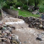
This is where the river channel empties into the lake. As you can see, this area is not nearly as big as the newer river channel above (the one constructed with huge chain-link bundles of rocks — the one that looked to be 12 feet high by 12 feet wide). I am no civil engineer, but I suspect that the smallness of this lower channel has a lot to do with why the rocks backed up above and caused the channel to plug at the soccer field.
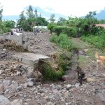
This is one section of property down by the beach, below the soccer field. The water came through here and completely washed away a large amount of the hillside. You can see some type of structure about to fall above on the right.
This is a wall by the beach, just below two nicer homes on the hill above. As you can see, water came rushing through here and washed away part of the wall. The next photos are of the the two homes above, on either side of what is now a very deep wash.
The home on the left is seriously damaged. It’s foundation is completely gone, leaving only poles dangling in thin air. It is hard from this angle to see how much damage has been done to the more humble home on the right.
A zoomed in photo of the more damaged home on the left.
Looking down at another large gully carved out of the hillside below the soccer field.
This photo is taken from the bottom of the soccer field, near where the river should be, looking back up toward the mountains. The goal posts with the blue netting are partially covered by several feet of mud. The Japanese restaurant used to be under the trees at the top of the soccer field on the left of the photo. The main town bridge (what used to be the bridge) is about 75 yards up the the channel toward the mountains. The small homes behind the soccer goal appear to be very lucky to still be standing.
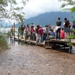
This photo tells a long story. It was taken at 11:27 a.m. on Sunday morning. As you can see, the water is only a few inches below the dock. Just two days earlier, the water was at least three feet LOWER. When boats pulled in here, you had to climb up on the edge of the bow, and then climb another two feet to step onto the dock.
Tropical storm Agatha turned away on Saturday evening. If it had continued to pound for two or three more days, as had been predicted, this would have all been underwater by several more feet, and the destruction to homes and property would have been much more severe.
The debris in the water here is just floating. Such debris is all over the edges of the lake. Many of the Mayan people have been gathering huge bundles of firewood from the river beds and beaches — a blessing of much needed cooking fuel in a time of disaster.
As of Saturday, all roads into and out of Lake Atitlan were either washed out or covered with debris or landslides, making them unpassable. San Marcos had no electricity or water system, and these people were hoping to catch some type of boat that might take them somewhere else on the lake.
It took several days for electricity to be restored, and the water in San Marcos is still not back to normal, as many of the supply lines up the canyon were wiped out.
Several days ago, the road from Panajachel out of the valley was opened just barely enough for small vans to leave. As of yesterday, vans from San Pedro can now leave the valley via different routes.
Sunday afternoon, after taking all of these photos, I learned that San Pedro still had electricity and water. Realizing how weak I was, and how bad my stomach problems were, I caught a boat to San Pedro late Sunday afternoon and have been trying to recover my health here. It is now Friday evening and I finally feel strong enough to eat something other than rice and bananas and toast.
Several of my friends also came to San Pedro to ride out the storm cleanup.
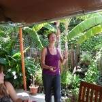
This is my friend Jessica trying to juggle, with Donna sitting at the table. We got together on Tuesday. They both left early this morning to head to southwestern Mexico.
When Donna and Jessica came to visit me in my room, I was still pretty weak from being unable to eat, so I decided to lay down for a while. This little kitty just wandered into my room, jumped on my tummy, curled up, and made itself comfortable.
Now, tomorrow morning, I have tickets to take a shuttle to Antigua, where I hope to have enough energy to begin writing about my adventures.
I am in great spirits, happy and content. While I am still quite weak, I am getting stronger every day.
I love you all
-Brenda
Copyright © 2010 by Brenda Larsen, All Rights Reserved




thank you for sharing those wonderful pictures and your experiences. i am glad that you are doing better and glad to hear you made it through the storm. hope you have a wonderful time at your next place of adventure. take care.
Thanks Cynthia. I appreciate your support.